If you warn them and they keep on sinning and refuse to repent, they will die in their sins. But you will have saved your life because you did what you were told to do. If good people turn bad and don't listen to my warning, they will die. If you did not warn them of the consequences, then they will die in their sins. Their previous good deeds won't help them, and I will hold you responsible, demanding your blood for theirs. But if you warn them and they repent, they will live, and you will have saved your own life, too. . . Some of them will listen, but some will ignore you, for they are rebels.
<< Ezekiel 3:18-22 >>
<< Ezekiel 3:18-22 >>
For I was hungry, and you didn't feed me. I was thirsty, and you didn't give me anything to drink. 43 I was a stranger, and you didn't invite me into your home. I was naked, and you gave me no clothing. I was sick and in prison, and you didn't visit me.' 44 "Then they will reply, 'Lord, when did we ever see you hungry or thirsty or a stranger or naked or sick or in prison, and not help you?' 45 And he will answer, 'I assure you, when you refused to help the least of these my brothers and sisters, you were refusing to help me.' << Matthew 25:41Matthew 25:42-45 Matthew 25:46 >>
Self-doubting prophecy
 View or Download the pdf format here
Nearly five years ago today, it was suggested to the Philippine Atmospheric, Geophysical and Astronomical Services Administration (PAGASA) to enhance its satellite capability instead of simply getting hand-me-down issuances from UN OOSA (United Nations Outer Space Affairs and the NOAA (United States National Oceanic and Atmospheric Administration) and the other geospatial information and intelligence agencies all over the world.
At a certain point in time around the period of the occurrence of the devastation by tropical storm Ketsana (Ondoy) in the Philippines, the PAGASA was clamoring for the purchase and installation of its Doppler radar system, an outmoded and unreliable system for weather forecasting.
In 2010, all throughout the government circuit, the company of Mr. Philip King called AAA, went on a lecture-presentation effort to sell the sensing and image capture technology developed by a Malaysian scientist and technology specialist who was also engaged in a similar high technology, extensive venture for the government of Canada, among other countries.
Had the Department of Science and Technology considered using a network of sensing stations with clear-photo capture capability on a 1-camera-per-station (or possibly a cluster of cameras), weather forecasting in the country, aided with charity hand-outs from NOAA, UNOOSA, the European Union, among other satellite capable agencies, will definitely be more precise at the same time vivid and viewable in real time.
It was foreseen in this site that absolutely nothing will be allowed by Typhoon Ketsana (Ondoy) to block its path. As early as the morning of the raging of this typhoon that PAGASA decided to merely attribute the powerful rains and killer floods to monsoons, it was already the consensus among the advocates that started this site that many people will die by Ketsana (Ondoy).
What kind of weather forecasting transpired during Typhoon Ketsana (Ondoy) was that by 10:00 AM up to 12:00 noon, PAGASA continued to refuse to declare even a Storm Signal No. 1 for Metro Manila and Rizal Province even at the height of severe rainfall, destructive and killer floods hitting entire subdivisions in Marikina and parts of Rizal, large areas in the urban center of the national capital.
In real time, it was being recommended strongly by this site that a state of calamity and state of emergency already be declared by the Office of the President.
When the media started reporting, albeit belatedly, that some people were reportedly getting killed by Ondoy, it may have dawned on PAGASA that their forecast needed to be amended. Nearing nightfall when panic and frenzy hit the public due to massive negative reports reaching media and feedback filtering through to the lower and highest levels of government, PAGASA relented and finally announced Signal No. 1. It was too late, Malacañang was then preparing to announce a serious state of calamity for the entire Metro Manila including parts of Rizal.
Hundreds died in Provident Village in Marikina. Hundreds died inside a popular Mall at the Riverside commercial complex built beside the huge Marikina River. Still hundreds others were swept by raging waters or seriously injured by stampeding objects and died instantly or were killed by being in the flood and unable to get help for their injuries.
The Haiyan (Yolanda) Fiasco
If the PAGASA did actually issue a warning, albeit introverted and timidly, about the storm surge in coordination with the rest of government, the evidence of the storm surge warning only appears at 5:00 AM on d-day, three hours before the storm surge hit Tacloban City on November 8, 2013 in the national disaster risk reduction agency (NDRRMC) Advisory called Severe Weather Bulletin No. 6.
Still and all, much, much earlier that day, Super Typhoon Haiyan (Yolanda) already passed through Tolosa, Leyte and hit neighboring towns beginning its slew of devastations across the entire length of nine Regions of the Philippines.
The NDRRMC Bulletin stated that:
"Residents in low-lying and mountainous (sic) under signal #4, #3, and #2 are alerted against storm surges which may reach up to 7-meter wave height (sic)."
ACTIONS TAKEN
o NDRRMC Operations Center disseminated Severe Weather Bulletin No. 6 on Typhoon Haiyan (Yolanda) to all OCD Regional Centers through SMS and facsimile and uploaded on the NDRRMC website for further dissemination to their respective local disaster risk reduction and management councils (LDRMMCs) from the provincial down to the municipal levels
o Directed RDRRMCs concerned through the OCD Regional Centers to undertake precautionary measures in their areas of responsibility (AOR) and subsequently advised local DRRMCs to initiate pre-emptive evacuation of families in low-lying and mountainous areas if situation warrants.
Had the one preparing the Severe Weather Bulletin (SWB) not merely cut and paste from one SWB to the next as can be observed in the various and different advisories issued by the NDRRMC, it must have been possible to introduce some new wording into these so-called severe bulletins.
The NDRRMC should have issued directives instead of the de cajon ACTION TAKEN jargon of "take precautionary measures." The directives could have contained marching orders coursed through the Regional Disaster Risk Reduction Management Councils (RDRRMC) of which the following are members, such as:
1. Armed Forces of the Philippines (AFP)
In connection with the warning of the threat of 21-foot or 7-meter high wave height as stated above, the AFP is hereby ordered to undertake, without need of callback and setoffs, forced evacuation to higher ground of all affected elements and population. . . This is not a drill.
2. Philippine National Police (PNP)
In connection with the warning of the threat of 21-foot or 7-meter high wave height as stated above, the PNP is hereby ordered to provide all manner of assistance to the AFP in the forced evacuation of all affected Service elements and population to higher ground, without need for callback and set off. This is not a drill.
3. Department of Social Welfare and Development (DSWD)
In connection with the warning of the threat of 21-foot or 7-meter high wave height as stated above, you are hereby ordered to comply with the forced evacuation order issued to AFP and PNP and to provide all manner of assistance and coordination with all affected officers and personnel of your agency and every item of relief designated for the evacuees, without any need for callback and set off. This is not a drill....
Just because the so-called Severe Weather Bulletin, did not emphatically state to forcefully execute an evacuation to safer ground, people who were caught by the storm surge unaware, got drowned and helplessly died under these 21-foot high waves from storm surges.
In Ground Zero in Tacloban City, two sets of 20-foot high waves converged from opposite directions to create more or less 40-foot high deluges. Even several hundred-ton to several thousand-ton ships were lifted by these approximately 15-meter high waves and brought into the ground in Tacloban City.
If multiple thousand ton objects such as ships, as in the Japan tsunami of 2011, could be lifted by the storm surge into the ground in Tacloban City, it would have been impossible for many people to survive the power and strength of the raging waters, accompanied by the stampede of debris from everything that the flash floods caught along the way.
All the rest of the highly authoritative Severe Weather Bulletins of NDRRMC do not contain a definitive order to evacuate nor even a redundant very stern warning about storm surge and a powerful order to vacate unsafe ground to ensure one's safety and survival.
NDRRMC Update re SWB No.12 (FINAL) for Typhoon YOLANDA (HAIYAN)NDRRMC Advisory re SWB No.12 (FINAL) for Typhoon YOLANDA (HAIYAN)NDRRMC Update re SWB No.11 for Typhoon YOLANDA (HAIYAN)NDRRMC Advisory re SWB No.11 for Typhoon YOLANDA (HAIYAN)NDRRMC Update re SWB No.10 for Typhoon YOLANDA (HAIYAN)NDRRMC Advisory re SWB No.10 for Typhoon YOLANDA (HAIYAN)NDRRMC Update re SWB No.9 for Typhoon YOLANDA (HAIYAN)NDRRMC Advisory re SWB No.9 for Typhoon YOLANDA (HAIYAN)NDRRMC Update re SWB No.8 for Typhoon YOLANDA (HAIYAN)NDRRMC Advisory re SWB No.8 for Typhoon YOLANDA (HAIYAN)NDRRMC Update re SWB No.7 for Typhoon YOLANDA (HAIYAN)NDRRMC Advisory re SWB No.7 for Typhoon YOLANDA (HAIYAN)NDRRMC Update re SWB No.6 for Typhoon YOLANDA (HAIYAN)NDRRMC Update re SWB No.6 for Typhoon YOLANDA (HAIYAN)NDRRMC Update re SWB No.5 for Typhoon YOLANDA (HAIYAN)NDRRMC Advisory re SWB No.5 for Typhoon YOLANDA (HAIYAN)NDRRMC Update re SWB No.4-A for Typhoon YOLANDA (HAIYAN)NDRRMC Advisory re SWB No.4-A for Typhoon YOLANDA (HAIYAN)NDRRMC Update re SWB No.4 for Typhoon YOLANDA (HAIYAN)NDRRMC Advisory re SWB No.4 for Typhoon YOLANDA (HAIYAN)NDRRMC Update re SWB No.3 for Typhoon YOLANDA (HAIYAN)NDRRMC Advisory re SWB No.3 for Typhoon YOLANDA (HAIYAN)NDRRMC Update re SWB No.2 for Typhoon YOLANDA (HAIYAN)NDRRMC Advisory re SWB No.2 for Typhoon YOLANDA (HAIYAN)NDRRMC Update re SWB No.1 for Typhoon YOLANDA (HAIYAN)NDRRMC Advisory re SWB No.1 for Typhoon YOLANDA (HAIYAN)In the case of Tropical Cyclone Haiyan (Yolanda) government had the proper information, but it was never shared and properly explained to the people who would become helpless victims. The public image this projects, if the PAGASA keeps repeating that they were in possession of the data about the deadly storm surge, the information was never really given much import.
On top of this, PAGASA and its sister agencies in government, two weeks after the extremely tragic incident, are saying through the ABS CBN and all the other Philippine media outlets that the warning about storm surge was already issued two years ago.
Needless to mention, the ideal role of the public sector forecasting and disaster readiness cluster consist of very simple functions:
1. Ensuring people safety (Detecting, forecasting)
2. Making people know (Announcement)
3. Making people understand (Brief Narrative, Explanation in Laymen’s terms)
4. Providing the people a course of Action (Command)
2. Making people know (Announcement)
3. Making people understand (Brief Narrative, Explanation in Laymen’s terms)
4. Providing the people a course of Action (Command)
All these things require on the other hand, the following support factors:
1. Forecasting Technical Capability
2. Credibility
3. Delivery Mechanism (Public Warning and Briefing System)
4. Capacity Building (Training, Educating People)
5. Quick Response Capability
6. Evacuation to safe haven
7. Relief, Rescue and Recovery
8. Forensic and mortuary operations (in case of MCI)
9. Rehabilitation, Reconstruction
2. Credibility
3. Delivery Mechanism (Public Warning and Briefing System)
4. Capacity Building (Training, Educating People)
5. Quick Response Capability
6. Evacuation to safe haven
7. Relief, Rescue and Recovery
8. Forensic and mortuary operations (in case of MCI)
9. Rehabilitation, Reconstruction
In evaluating and assessing the behavior of the Philippine weather bureau – Philippine Atmospheric, Geophysical and Astronomical Services Administration (PAGASA) prior to and during super typhoon Haiyan (Yolanda), it is clear that scientists and managers of PAGASA and Philippine Institute for Volcanology and Seismology (PHIVOLCS) cannot serve fittingly by being trapped in ivory towers or hermetic refuge.
Further, it is not to the benefit of the greater public at large for scientists at PAGASA and PHIVOLCS to slowly grow into the seductive role of reporters for broadcast networks.
On the other hand, the disseminators of early warning did nothing positive as shown above. To compound the situation, it was barefacedly reported to the public over the government’s national television network by a representative of the Office of the President’s Philippine Information Agency (PIA) eastern Visayas regional office that she had sent numerous SMS to local government officials through the Philippines Smart Telecom Text Blast application about the storm surge reaching as high as 21 to 30 feet.
This method of communication proves to be very inexpensive for the PIA and government as a whole, but fatal for the unknowing public.
This method of communication proves to be very inexpensive for the PIA and government as a whole, but fatal for the unknowing public.
Up to the very final minutes prior to the 0800H 08 November 2013 onslaught of super typhoon Haiyan (Yolanda) the female PIA Region 8 official said she was still sending text messages and called someone on mobile telephone and during her talk with the called party, she overheard the powerful sound of the raging waters that engulfed whoever it was she was warning about the danger. Silence followed, she told the People’s Television Network anchors and studio audience.
The same agency, PIA Region VIII stated that the government prepositioned relief goods. That all these prepositioned relief goods were destroyed by the storm surge that she had clearly been informing local government officials about.
If the government actually knew about the storm surge clearly, why supposedly preposition the relief goods in the very area where the storm surge will damage them?
The international media declared that a lot of statements made by the Philippine public sector about Haiyan (Yolanda) appeared to be dubious, suspicious for being highly contradictory. Without doubt, this brought the untimely death of +6,000 people.
After the super typhoon devastated mostly Tacloban City and nearby towns, humanitarian relief assistance did not arrive until after more than nearly two weeks.
At the time of the disaster, only the wife of the local chief executive was in the locality, some quarters say.
Her spouse, the local executive, was one thousand one hundred three kilometers (1,103 km) away participating in extreme sports – highly confident that disaster readiness actions were undertaken.
While the father of the City and his family was far away, the lady of house was reportedly hit by the storm surge and barely survived; she had to make do in the aftermath of the typhoon with receiving food and borrowing personal items from her closest friends.
On the other hand, the Philippine President, His Excellency Benigno Simeon Cojuangco Aquino III, President of the Philippines declared that the “Systems failed, what else could he have done?”
During his press briefing at Tacloban City on November 18, 2013, ten days after the super typhoon, President Aquino complained about the overwhelming power of Haiyan (Yolanda) that all systems went down.
The government workers became victims themselves. Relief goods were damaged.
President Aquino could not mention that along with the relief goods in the government base operations center that had spacious room for evacuees, the helpless people drawn out of their homes during evacuation procedures and brought beside the relief goods, died from the storm surge inside the evacuation centers.
As for the relief items, these are all in a list and no one needs to account for them now. Still, solutions to these kind of oversight need to be applied in the future.
Social, Political Perspectives
It is evident that several questions need to be answered. Prior to the incident, why a local executive would hurry off to participate in extreme sports in a place not predicted to be hit by the super typhoon is certainly an issue.
Were the weather forecasts not enough to convince this local government head of the danger to his area of responsibility?
After the incident, why the foremost leader of the country will delay the staging of humanitarian relief and assistance operations for a wholly devastated part of the country will be remembered by the people in the Philippines for a very long time.
Nearly a week after November 8, 2013, why a public sector weather bureau officer would state on national media, three days after Typhoon codename Haiyan aka Yolanda hit the Philippines, that his agency gave warnings about storm surge accompanying Haiyan (Yolanda) one week before and implied that nothing was done about the warning is difficult to fathom.
The officer said that he warned of several meters high of floodwaters from storm surge. He completed his lamentation to national media that he did actually relay information warning about the storm surge.
The officer said that he warned of several meters high of floodwaters from storm surge. He completed his lamentation to national media that he did actually relay information warning about the storm surge.
At this time, the myriad of problems brought about by the damage from the storm was already well spread out through world media, the social networks and spreading like wildfire through electronic devices (tablet, note pads, mobile phones, etc.)
It becomes immaterial whether the weather bureau agency PAGASA will then decide negatively on the fate of the specialist for being remiss in serving the people, but that government as a whole was neither able to act with dispatch nor in the appropriate manner.
Given political color, the government leadership appeared to the entire international community not too predisposed to provide the proper response to the helpless victims for its very resolute and principled stand, however amoral and unconscionable that posture may be against an enemy political party in Tacloban City (the disaster hit nine Regions of the Philippines not only the City of Tacloban).
On the part of the government’s national disaster risk reduction agency NDRRMC, it discussed the storm surge in passing with media together with the PAGASA during its pre-disaster press conference but showed signs of not remembering correctly what happened during Sendai and Fukushima when tsunami hit Japan and when powerful storm surges only recently threatened much damage upon the United States on several occasions.
In the past, with a minimum of twenty tropical cyclones per year, in selected occasions many areas in the Philippines suffered excessive, sudden deluges of surface runoff water not excluding among them Metropolitan Manila as evidenced by the images seen below from ibtimes.com, Mindanao and the North as well as the Central plains of Luzon. Since Mt. Pinatubo, in 1991 and due to the desertification of lower Ilocandia (Pangasinan), very sudden flash floods occur in Eastern and Central even when there is a mere few centimeters of rainfall.


A German scientist sensibly ventilated the suggestion to seed with grass and eventually to aggressively vegetate, generate new forest cover (the former one being totally depleted) upon the higher grounds overlooking both Pangasinan and parts of Central Luzon such as Zambales, Tarlac and Pampanga.
The scientist had correctly argued that due to billions of tons of ash deposited in the mountain range in Eastern Pangasinan (bordering with Ilocos and Central Luzon), the tendency was to simply transfer all the rain and other form of water down to the lower zones, water having the unique quality of seeking its own level. Furthermore, there was danger that these billions of tons of ash, while they might solidify, will become the source of massive future landslide threats.
A social development institution unremittingly advocated the cause espoused by the scientist from Germany with the regime of former President Fidel V. Ramos, however the response from the public sector was extremely wanting. Needless to say, the dire effect of having ash in those high areas, and having them fall or slide into the lower parts within the territory of Urbiztondo, Pangasinan, border towns of La Union nearby, was not simply the siltation of rivers.
A social development institution unremittingly advocated the cause espoused by the scientist from Germany with the regime of former President Fidel V. Ramos, however the response from the public sector was extremely wanting. Needless to say, the dire effect of having ash in those high areas, and having them fall or slide into the lower parts within the territory of Urbiztondo, Pangasinan, border towns of La Union nearby, was not simply the siltation of rivers.

Flash flooding in Pangasinan. After Pinatubo's eruption, without post-disaster pro-active measures, flash floods inundated Pangasinan. A few months after warnings were sounded out by Centre Humanes about big floods, 11 towns in Pangasinan disappeared from the map during heavy flooding that never happened in the past.
Whole chunks of what could be perceived as huge white rocks and smaller debris that were actually solidified ash silted, or squatted in, rivers and made them extremely shallow.
Farmers in 1992 up to 1995 and henceforth, complained that the irrigation of their corn and rice crops, was no longer like the old times. Their primary source of flowing water had gone shallow and could no longer supply irrigating water for their corn and rice. This was on the eastern side of Pangasinan.
Extremely shallow rivers of Pangasinan and bordering Ilocos towns - heavily silted with volcanic materials

Baguio killer earthquake of 1990

Mount Pinatubo eruption in 1991

Ormoc Flash Floods that killed more than 5,000 people

Ormoc Flash Floods

Most Recent - Haiyan (Yolanda) - killing more than 6,000 people


With the heavy siltation of the Agno River (left photo) by normal erosion and the mining activity farther ahead in the Cordilleras on the Western side and the denudation of the forests therein, the coastlines of Lingayen, Alaminos and other neighboring towns accumulated tremendous amount of silt. On board a helicopter, one can observe the browning of the entire length of the Lingayen Gulf become evident as opposed to the greenish to blue hue of the waters far beyond: one needs to look very, very far away from the beach to see the change of color from murk to the usual aquamarine color of the sea.
Whether government will continue to neglect the problem or will find a means to correct the situation, will determine the kind of impact that the next big disaster will have on Central Luzon and the Ilocos Region. At this point, it is safe to say that the effects would be severely tragic in the same way that Yolanda was clearly very devastating.
Typhoon Haiyan (Yolanda)
A cause for concern during and in the aftermath of Typhoon Haiyan (Yolanda), is that many quarters claiming ample understanding of the phenomenon called Yolanda and her sister typhoons, have repeatedly been persuading one and all that “no one can predict a tropical cyclone.” From November 10-13, 2013, this was almost the common fare in Philippine media.
The claim is clearly uninformed. What is at stake at this point is the current state of the public sector to undertake relief, medical assistance, forensic and mortuary operations along with other efforts upon which hang the lives of countless numbers of populations trapped in a disaster zone. Even if the head of state himself announces that government had the capacity to produce 50,000 relief packs per day, this was not adequate, considering that 9.8 Million Filipinos have been rendered homeless, helpless and ill-equipped to fend for food, shelter and clothing in the immediate aftermath of the storm.
Had it not been for the swift response of foreign donor countries, private sector groups, networks of families pitching in to help the unattended victims in Tacloban City and many other areas in the 9 affected Philippine regions, the casualties of around 6,000 would have doubled or tripled with the number in excess of the 6,000 killed by hunger, illness and other post-disaster causes.
After persuasive comments from the private sector, DSWD announced it will increase its relief repacking centers and will be able to deliver 2,000,000 relief packs in a week. Still not enough. At the end of it, the major challenge to the Philippines is minimize the damage to communities and loss of life in future catastrophes as powerful as Haiyan (Yolanda) and lessen the incidence of post-disaster casualties as well.
Prior to the disaster, the National Disaster Risk Reduction Management Council, under normal circumstances NDRRMC does not issue the forecasts of calamities that will hit the Philippines. That falls under the purview of the forecasting cluster.
However, the Secretariat of NDRRMC, the Office of Civil Defense (OCD), a bureau of the Department of National Defense (DND), has a plan to put in place a Project DINA – this stands for Disaster Information for Nationwide Awareness Project. The OCD website published the following brief on this project:

However, the Secretariat of NDRRMC, the Office of Civil Defense (OCD), a bureau of the Department of National Defense (DND), has a plan to put in place a Project DINA – this stands for Disaster Information for Nationwide Awareness Project. The OCD website published the following brief on this project:
Project DINA
Profile
One of the challenges in the drive to build a prepared, adaptive and disaster–resilient Philippines is to promote public awareness on disaster preparedness.
The Philippines, one of the signatory countries in the Hyogo Framework of Action (HFA), has been constantly seeking for innovative means to educate the general populace in response to HFA’s Priority Action 3: Use knowledge, innovation and education to build a culture of safety and resilience at all levels.
The Disaster Information for Nationwide Awareness Project or Project DINA is the Philippines’ proof of commitment to the realization of the HFA’s priority action 3.
Project DINA paves the way for the public exposition and access of disaster risk reduction and management (DRRM) information materials. The project showcases a number of audio–visual presentations (AVPs) which discuss DRRM topics, enabling the public to undergo online DRRM–related instruction. Through this system, the public can gain disaster preparedness knowledge on what to do before, during and after the following hazards:
Earthquakes Tsunami Tropical Cyclones
Landslides Floods Volcanic Eruptions
Fires
This project will be officially launched to the public on November 2013.
Under Project DINA, the NDRRMC signed an agreement with UBE Media, Inc. stating its objectives thus:
The MOA is for the production of audio-visual presentations which discuss disaster preparedness topics for the Disaster Information for Nationwide Awareness Project or Project DINA of the NDRRMC-OCD. This project involves other government agencies: PAGASA, PHIVOLCS, MGB, NAMRIA, CRSAFP, CEISSAFP, PCOO, and PIA.
Project DINA includes the creation of an online venue which will enable the public to access disaster preparedness information. It will showcase discussions on what to do before, during and after the following hazards: earthquakes, tsunami, tropical cyclones, landslides, floods and volcanic eruptions. This project’s system will also gauge the level of awareness of the public through a knowledge assessment tool that will administer short examinations about DRRM topics as well as collect and interpret the results for the use of NDRRMC-OCD as basis for succeeding projects.
The use of the internet is well and good. The inexpensive means of communication of the Office of the President’s Philippine Information Agency – the Mobile Phone Text Blast is also useful, up to a certain extent.
However any project of the government like this may be launched, the final measure to determine their effectivity in mitigating disaster risks is how many lives the projects are successfully able to save during a calamity and how many more survivors are cared for in the aftermath of the disaster.
Government can rely on models
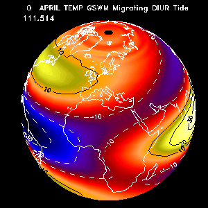
There is absolutely much to gain in the positive, constructive use of precedents, models, patterns, trends. Everyone knows from experience that knowledge is layer upon layer of built up inputs from one’s own and other’s experiences. The National Center for Atmospheric Research (NCAR) put up a Global Scale Wave Model (GSWM) that could provide a better understanding and forward perspectives on hydrologic movements around the world.

NCAR also has a program to monitor the sun’s activity under its High Altitude Observatory (HAO) due to the discovery by Dr. Richard Carrington of very powerful solar action that destroys or burns up electrical lines, electronic gadgets and disrupts regular human and societal activity.
 Top: Image of the Sun taken on October 15 2013 by the Atmospheric Imaging Assembly (AIA) telescope that flies on the NASA Solar Dynamics Observatory (SDO) satellite. Most of the sunspot activity in this image can be seen in the Sun's Southern Hemisphere, while the Northern Hemisphere seems to have already gone through its peak in activity.
Middle: Shows a record of sunspot area measures going back to solar cycle 12 in 1898. Areas are measured in millionth of solar hemisphere and averaged over three solar rotations.
Bottom: A drawing by Johannes Hevelius created in 1644, one year before the start of the Maunder Minimum, shows the passage of a large spot across the solar disk, which occurred over eight consecutive days.
On the other hand, the Group on Earth Observations formulated the global earthquake model called Supersites wherein the chosen biggest candidate earthquake sites from all over the world are plotted upon the global map and constantly observed and monitored for seismic activity.

Shown below are the sample candidate big volcanic and earthquake sites that passed evaluation and are now included under supersites.

The earthquake faults at San Andreas, Iceland, Hawai’i, Italy’s Mt. Etna and New Zealand at this time are considered as permanent supersites.


The experience of the United States, Indonesia and other parts of Asia, together with many other countries in recent past on storm surge, the major Japan tragedy from tsunami, as well as the minor tsunami in Mindanao play a large role in understanding what happened in the recent Category 5 Hurricane Tropical Cyclone Haiyan (Yolanda) storm surges that hit the Visayas and parts of Mindanao.
Calamities emanating from many other forms of natural or even human-made causes, in various levels were also documented in the past.
By coordinating as much of the documented knowledge from these disasters, a key responsible institution such as a disaster forecasting or response agency (e.g. Mongolia Institute of Meteorology and Hydrology, United States of America’s US Geological Survey and the NOAA hurricane forecasting, the Philippines’ National Disaster Risk Reduction Management Council, etc.) will be able to cull the significant benchmarks on the kinds of natural or other occurrences and the various kinds of response to various calamities.
Thus, in the future, the lessons learned from this coordinating and compiling of data arising from experience of past calamities is a tool to help open the eyes of and enlighten officials, the scientific community, as well as the greater population, about future disasters.
With thorough information, it is possible to arrive at clearer forecasts. With such kind of forecasts the task of bringing down the information to the people is the next hurdle.
With thorough information, it is possible to arrive at clearer forecasts. With such kind of forecasts the task of bringing down the information to the people is the next hurdle.
In the past, Centre di Humanes et Societas, Inc., together with the Office of Civil Defense, Department of National Defense, pushed for the installation of Public Warning Systems in the country as early as 1992. Until this time, it is awaited if the government will seriously consider putting up early warning for more people to survive during disasters.
Equipped with public address systems, computers and in areas where needed also with electric power generators. The command and control console enables the system operators to monitor the dissemination of advisories and warnings to the public on a one-way, feed-forward basis.
The feature of the Public Warning System being proposed at the time (1992) had the capability to integrate announcements to the public through a network of public address systems to radio, television and mobile phone frequencies to increase the number of recipients that will get the warnings.
Like the Philippines, too many countries up to this time, do not have adequate forecasting and public warning systems. This was evident even in the occurrence of the Bandar Aceh, Indonesia tsunami that extended up to the Indian peninsula leaving more than two hundred thousand people dead; the Haiti earthquake that claimed 300,000 lives; the Japan earthquake and tsunami that left tens of thousands dead; the recent super typhoon Yolanda that killed nearly 10,000 victims and a score of other disasters all around the world.
Notwithstanding having powerful forecasting capability, the future of any country in confronting calamities is uncertain in areas where people refuse to cooperate, fiercely resist efforts to evacuate them from their present niche despite the high risk from calamities or simply shun any other efforts to forestall dangers to life and property. Governments are not always inclined to move them by force or attempt to evacuate at all.
HMES since November 2009 sought to generate strong focus on targeted solutions to specific issues all of which serve to strengthen a state’s capacity to improve forecasting and enhance its disaster readiness:
1. Encourage broad policy regime change, paradigm shift, to enable governments to undertake interventions to reduce hazards including but not limited to, modernizing the state’s forecasting capability.
2. Foster a culture shift for the people not to stand in the way of reform, change and intervention.
3. Enjoin the compiling of all available earthquake, hydrogeologic and meteorologic models, among others into a Global Geohazard System.
4. Factor in natural aside from industrial causes Greenhouse Gases (GHG) into Disaster and Climate Change risk parameters.
5. Study natural and man-made land deformations or wetlands defacements including altering life and inorganic objects therein should be seriously studied and factored into future Disaster Risk Reduction (DRR) activities.
6. Signing Declaration to observe a particular year as International Hazard Mapping Year.
7. Signing Declaration for observing a particular month of every year thereafter as the Disaster Risk Reduction Month.
8. Signing Declaration for observing a particular date of a month of every year thereafter as the International Hazards Awareness Day.
9. Signing expanded agreements between UN, member nations on sharing of GIS on disasters and information from outer space.
10. Signing Declaration making outer space information and GIT Infrastructure more available for the poor nations.
11. Publish both government and international combines’ data on geohazard whether on natural setting or involving human-made structures.
12. Amend all obsolete national or state laws, statutes, rules and regulations that instead of engendering disaster risk mitigation, will only become the cause for greater casualties and devastation during disaster.
13. Internationally criminalize persons and institutions that place the lives of individuals and whole populations in danger from forthcoming disaster or exacerbate the miserable fate of victims after a disaster.
14. Unify policy advocacy in the public sector by rationalizing the assigning of functions and responsibilities to both individuals and agencies.
15. Whether by public sector effort or private sector initiative, to build the Philippines’ Geohazard Mapping and Emergency Communications Center.
16. Signing Declaration imposing the act of relocating habitats that lie directly upon the path of disaster and enjoin the international private enterprise sector to support, apart from government’s efforts, private-led initiatives to help reconstruct for and resettle communities vulnerable to disasters.
Related Topics:
For relocation away from danger zones:
KORONADAL CITY (MindaNews/4 November)– The city government is planning to develop a 2.4-hectare resettlement area for local residents situated in calamity danger zones and those who were displaced by the recent floods and landslides that hit the area. Read more here >>
As a first priority, the assessment should determine the safety of damaged buildings for human use.
This will be followed by the estimation of reconstruction costs of buildings and other infrastructure in each sector of the economy. Assessment must determine the costs of the introduction of hazard safer construction measures. This will include the need for strengthening or relocation of buildings and facilities to ensure their safety from future events. >>
BAGUIO CITY—Encouraged by Malacañang’s decision to proceed with the relocation of squatters lining Metro Manila waterways, provinces in north and Central Luzon have decided to resettle communities living in geologically hazardous areas to reduce flooding and landslides. >>
Secretary Florencio Abad: “Besides relocating poor families particularly those in flood-prone or high-risk areas, this fund release will also allow SHFC to give poor families the opportunity to secure their own property,” >>
The Country Fire Service have developed a fact sheet to communicate the Fire Danger Ratings; Severe, Extreme and Catastrophic, click here for Fire Danger Ratings.
CFS have also development fact sheets explaining where to relocate on the days of Severe, Extreme and Catastrophic Fire Danger, which can be sourced from the link below: >>
… Of specific interest was to learn from those people responsible for the evacuation process and shelters, and the subsequent reconciliation of family, donated goods management, housing recovery process and relocation challenges. >>
In 2006, one of the world's worst landslide hit Southern Leyte that almost wiped out the entire 480 hectares in Barangay Guinsaugon, one of the 16 villages of the town of St. Bernard. The disaster left in its wake 28 injured, 410 registered survivors and buried alive at least 1,000 people >>
… The alert level for the Mayon volcano went down to 2 on the 13 January and most families have been able to return to their communities. However, there are plans in place to permanently relocate the families who live within the 6km permanent danger zone. UNICEF contributed with water kits, medical supplies, tents, information support materials and psycho social activities during the evacuation. >>
Comparative view:
Forced migration due to climate change will present one of the most severe challenges to the resilience of communities forced to migrate as well as to local and national governments. The Intergovernmental Panel on Climate Change (IPCC) has identified the regions of the world most vulnerable to climate change and predicts that 150 million people will be displaced by 2050. Erosion, flooding, and sea level rise will be the primary causes of displacement. Water and food security issues, due to drought and salt water intrusion, will also impact the sustainability of communities. >>
The need to relocate entire communities as a result of climate-induced environmental change is an extreme form of adaptation. If climate-induced environmental change renders entire communities uninhabitable, it is critical to understand the governance tools and human rights protections that can foster community resilience. Newtok's relocation provides an example of a model governance structure where the Newtok Traditional Council is leading the community's relocation effort and federal, state and tribal governmental and non-governmental organisations are providing the community with the technical assistance needed to build the infrastructure at the relocation site. However, despite this model working group, the institutional barriers to the relocation process have been enormous. >>
· Relocation is not only about rehousing people, but also about reviving livelihoods and rebuilding the community, the environment, and social capital. >>